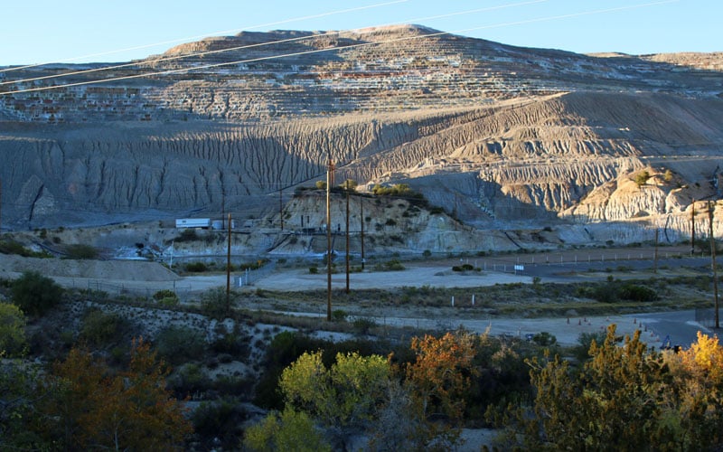
A mining operation located along the U.S. 60 between Superior and Globe. A copper mining company wants to put operations in Oak Flats, about five miles away. (Photo by Bri Cossavella/Cronkite News)
SUPERIOR – Oak Flat, a desert landscape and 90-minute drive outside Phoenix, lies in the midst of an environmental and economic controversy.
Members of the San Carlos Apache Tribe revere the federally owned land as sacred. Environmentalists consider it a sanctuary for wildlife and vegetation. Climbers, hikers and campers gravitate to Oak Flat for outdoor recreation.
And Resolution Copper Co. covets the rich veins of copper running below the surface of Oak Flat.
In December 2014, Congress passed and President Obama signed the National Defense Authorization Act for Fiscal Year 2015, which authorized Resolution, a Phoenix-based affiliate of foreign mining companies Rio Tinto and BHP Billiton, to perform mining operations in Oak Flat in exchange for other land in Arizona.
The lengthy document is primarily made-up of military reform and funding and has passed consecutively for about 50 years. Sen. John McCain, R-Arizona, secured Resolution’s bill on the act, according to a Cronkite News article.
Prior to the bill passing, Resolution submitted their plan of operations to the U.S. Forest Service’s Tonto National Forest. The forest service “accepted” their plan, but has yet to approve it. Now that the bill is the law, federal government agencies have no choice but to carry it out as long as certain requirements are met, said John Scaggs, spokesman for the forest service.
Environmentalists and the tribe remain opposed to a mine, which Resolution said it needs because it would create jobs, boost Arizona’s economy, and copper is “a key ingredient in wind and solar energy.” Company leaders propose exchanging eight land parcels across Arizona for mining Oak Flat.
The land exchange
In addition to a mining operation, Resolution proposed a land exchange. Company officials will give land it currently owns to public land managers, like the U.S. Forest Service and Bureau of Land Management, in exchange for the land that rests above the copper stores.
The land parcels are scattered across the state near places like Payson, Cave Creek and Mammoth. The parcels make up about 5,300-acres in total. After the swap, Resolution would own about 2,400-acres of land, including Oak Flat, according to the forest service website.
But the mine is projected to affect nearly 7,000-acres of surface land, according to the forest service website. It would extend 7,000-feet below the surface and be labeled as the largest copper mine in the United States, leaving behind a 1,000-foot deep crater, according to Resolution’s website.
Resolution Copper spokesman Bill Tanner declined several interview requests, referring Cronkite News to its website for information.
A “bipartisan group of leaders,” “local communities” and Resolution officials came together to decide which lands would go to public land managers, according to their website.
Equal value
A government appraiser will be jointly selected by the forest service and Resolution to evaluate and determine if the proposed lands are of “equal value” while abiding by nationally recognized standards.
If the appraiser concludes that the lands are not of “equal value,” Resolution will have to give up more land or pay the federal government to make up the difference, according to the forest service website.
The selection process for the appraiser is under way and the evaluation is expected to begin in 2017, Scaggs said.

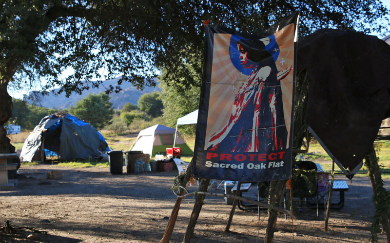
Members of the San Carlos Apache Tribe set up a camp near the entrance of Oak Flat campground showing they oppose a proposed copper mine. (Photo by Bri Cossavella/Cronkite News)
Cultural objections
Wendsler Nosie Sr., councilman of the San Carlos Apache Tribe, said in terms of cultural value, the other land parcels don’t fit the bill. Nosie Sr. is also a representative of the Apache-Stronghold, an organization opposed to the proposed mine.
“In ancient times and today, references to Oak Flat can be heard in our songs, rituals, teachings and language,” he said. “Understand that any land base is important because there’s purpose to each of them, but Oak Flat is everything that makes us who we are.” He called the mine the “genocide of our religion.”
Nosie Sr. said if Christians wanted to explore the depths of their religion, they can go to Europe where preserved buildings and monuments stand today — Oak Flat is symbolically identical and future generations wouldn’t be able to connect to it if its altered.
One of the parcels Resolution is proposing is a section of Apache Leap — a historically known jagged cliff near the town of Superior. In the late 1800s, members of the Apache Tribe plummeted off of it, greeting death, rather than being captured by U.S. Cavalry, according to a reflection of an article, “The Legend of how Apache Leap got its name.”
“We respect the importance of the Oak Flat area to many Native American people, and have committed to give the public access to the Oak Flat campground for as long as it is safe,” Resolution’s website says. “We hope we can work with neighboring Native American tribes by answering and addressing their concerns.”
Public exception
If the swap occurs, the land parcels would be considered “public” while under the ownership of public land managers, but one parcel would remain mostly off-limits to public recreation.
The Appleton-Whittell Research Ranch, an affiliate of Audubon Arizona, conducts research and preserves grassland ecosystems and manages 940-acres owned by Resolution. The research ranch manages 8,000-acres, according to their website.
After the swap, all that would change is ownership, said Sonia Perillo, Audubon Arizona’s executive director. The 940-acres would continue to be used for conservation purposes on behalf of the research ranch.
With permission, the general public can access a limited number of roads and trails, according to the ranch’s website.
Robin Silver, co-founder of the Center for Biological Diversity, committed to preserving wildlife and habitats on the brink of extinction, opposes the land exchange and mining in Oak Flat.
“The American public is getting ripped off,” Silver said. “The only land that is of value is the research center’s because it hasn’t been overgrazed, but it’s of no value to the general public because it wouldn’t be open to them, unlike Oak Flat that offers recreational opportunities to the public and is of cultural value to Native Americans,” Silver said.
According to Resolution’s website, the parcels they are proposing to trade are home to archaeological sites, destinations for rock climbers and nature trails.
How the parcels would be managed would be up to its prospective owners — the Bureau of Land Management and the U.S. Forest Service.

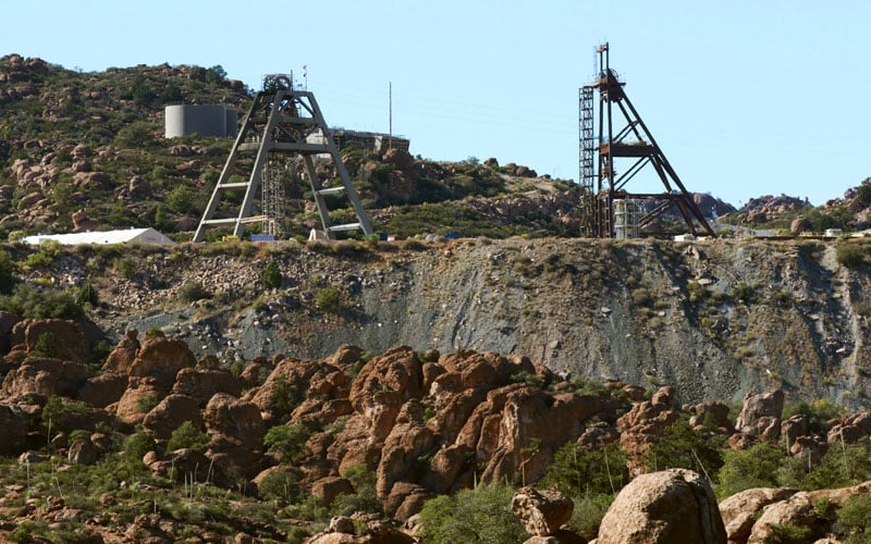
A frames are structures used in the mining process. These can be spotted west from the Oak Flat campground near the town of Superior. (Photo by Bri Cossavella/Cronkite News)
Environmental
Resolution included lands that are of “high-priority (for) conservation,” according to the forest service.
One parcel includes seven-miles of the San Pedro River that would become part of the San Pedro Riparian National Conservation Area. Other parcels include creeks, wetlands, and an abundant amount of wildlife, according to Resolution.
Perillo said Audubon Arizona officials agree the proposed lands are valuable for preservation but question the environmental consequences of mining in Oak Flat.
During a period the forest service accepted public comments and letters in reference to the mine, Audubon Arizona raised concerns about threatened and endangered species, water quantity and quality, and the tailings pile, the pile of leftover rock particles once copper is extracted.
Resolution’s website says company officials would protect plants and animals by “removing vegetation only when it is absolutely necessary” and “using covers and containers to keep birds and other animals out of areas of the mine where they could be injured.”
Nosie Sr. fears water could become contaminated.
“Beneath the surface, everything is intertwined,” he said. “It’s not just Oak Flat. Water in the valley and across the state will be affected.”
Nosie Sr. said the tribe and its lawyers are working with the forest service to address concerns.
Resolution’s website says company officials will reclaim the land after the mining operation is complete to replant vegetation and ensure land and water are “safe.”
The mine would take ten years to build, would operate for 40 years, and then about 5 to 10 years for reclamation, according to the forest service website.
The mining operation is estimated to create 52,000 local jobs and push billions of dollars into the state’s economy, according to Resolution’s website.
Public comment
The forest service is completing an environmental impact statement, a mandatory document under the National Environmental Policy Act of 1969. The statement process includes accepting public comments and analyzing potential positive and negative environmental changes because of the proposed mine.
The completed statement would guide mining operation and outline other federal actions to protect the environment, Scaggs said.
Photo credits in map:
Turkey Creek: Photo by The Old Pueblo via Creative Commons
Cave Creek: Photo by The Real Cloud2013 via Creative Commons
East Clear Creek: Photo by Brady Smith of Coconino National Forest via Creative Commons
Apache Leap: Photo by ArizonaLincoln/HoppingRabit34 via Public Domain
San Pedro River: Photo by The Old Pueblo via Creative Commons