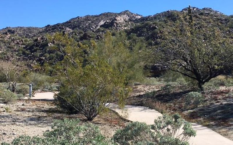
PHOENIX – Ask Brian Gootee of the Arizona Geological Survey how the mountains ringing metro Phoenix formed and you’ll get what sounds like a riddle:
“When you think about this flat (Salt River) valley, I think you have to kind of start over with what it wasn’t, right before it started to become what it would be,” he said.
Gootee simply means that, in the days of the dinosaurs, the area was a mountain range, built by the same kinds of tectonic forces currently uplifting the Andes in South America.
“You have these studded hills and mountains – like 10-, 15-, 20,000-foot peaks – and they’re volcanically active. And that’s what this place looked like,” he said.
Then the tectonic plate motions changed, and the Southwest stretched to two to three times its former size. Like a caramel-filled chocolate bar, its surface cracked and fractured, while its “gooeyer” lower layers stretched and deformed, Gootee said.
“South Mountain, the Estrellas, maybe, San Tans, White Tanks, Sacaton mountains – all of these mountains, like in the McDowell Mountains as well – those start to form as nascent mountains around 25 to 20 million years ago,” he said.
Amid these fractures, some blocks of rock rose to become mountains while others dropped to form valleys. This was the birth of the undulating basin and range system that today wraps around the Colorado Plateau.
The extreme topography created by these faults and blocks has since been hidden beneath millions of years of sediments and eroded gravels.
“If we were out at Luke Air Force Base, and you suddenly took away all that sediment, you’d fall a long ways. You’d fall a mile and a half,” said Steve Skotnicki, an independent researcher who uses drill cuttings from water wells across metro Phoenix to map the area’s geological and hydrological prehistory.
In fact, many of our mountains and buttes are actually the tips of many-miles-deep blocks, poking up like the corners of books tilting on a shelf, he said.
Some comprise truly ancient rocks. The Phoenix Mountains – North Mountain down though just south of Piestewa Peak – are 1.7-billion-year-old rocks that have endured eons of punishment.
Gootee described it this way: “Other continents have come and gone and hit him and been pulled away and, and hit him again, and been pulled away, and slid past them and buried them in, uplifted him and eroded them and buried them again.”
Rocks in the western area of South Mountain and in the White Tank Mountains are of similar vintage. Rocks that ancient can pose particular problems for scientists trying to unravel their history, Gootee said.
“It’s like going into a car-crushing factory that’s been around for a hundred years, and you’re asked to go in there and reconstruct all of those vehicles and the makes and the models and put them back together and tell us a story about the evolution of cars.”

South Mountain in Phoenix was formed 25 million to 15 million years ago, geologists estimate. As the mountain domed up, it shed the blocks that became Camelback Mountain and the Tempe Buttes. (Photo by Christina Estes/KJZZ)
South Mountain arose from the hotter “caramel” layer 6 miles beneath the surface.
“Twenty-five (million to) 15 million years ago, the continental crust was stretched, and the rocks in the South Mountains were pulled out from underneath that area to the northeast, underneath Fountain Hills, and brought up to the surface,” said ASU geologist Steve Reynolds, an expert on bedrock features in metro Phoenix.
As it domed upward, South Mountain sent fault blocks sliding down into the valley. Today, we know these blocks as Camelback Mountain and the Tempe Buttes.
“The tilting of those blocks is what accounts for the tilted layers in Papago Park and in the volcanic rocks around the ASU campus,” Reynolds said.
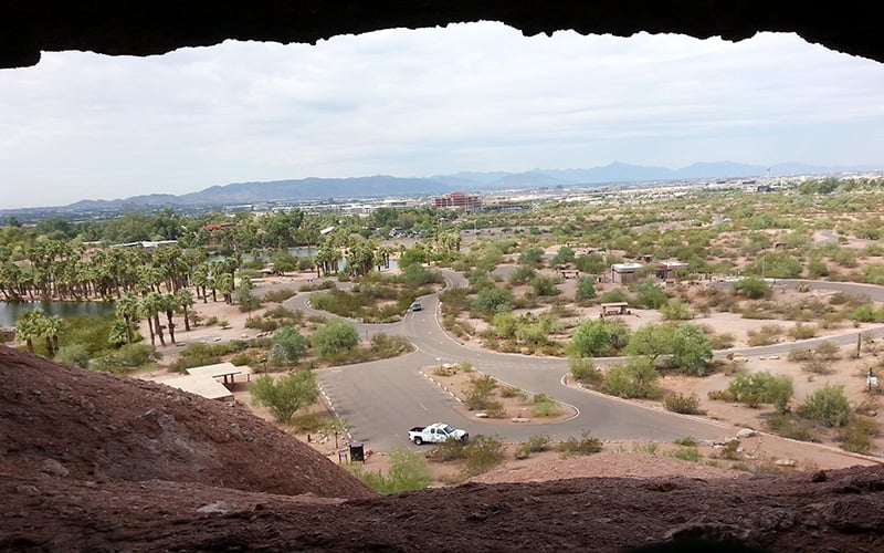
The rocks at Papago Park, including Hole in the Rock, likely were deposited by landslides along a steep mountain front that has since eroded away, he said.
“There is a huge landslide block that’s probably a mile long and 30-, 40-, 50-feet thick,” Reynolds said.
The “hump” of Camelback Mountain is made mainly of granite, which forms via volcanic activity underground. But the Camel’s Head Formation is composed of sedimentary rock, which forms from particles deposited on the floor of a body of water.
In between the formation of the former and the latter lies a vast gap in geologic time that’s even greater than Great Unconformity visible at the Grand Canyon.
“It represents a period of time,” Skotnicki said, “almost 1.5, 1.6 billion years of earth history that’s gone, because the granite is about 1.6 billion years old and these sediments are maybe 20 million.”
The Superstition Mountains are the remains of an ancient supervolcano not unlike the one slumbering beneath Yellowstone National Park. Such volcanoes blast material skyward with hundreds or thousands of times the power of the 1980 Mount St. Helens eruption in the Pacific Northwest.
“If you go down to the San Tan Mountains,” Skotnicki said, “you can still see several hundred feet thick of those deposits, 40 miles from the Superstitions.”
Gootee said a supervolcano essentially is “a shotgun that just blows a hole in the crust. There’s no time, there’s no chemistry, there’s no physical opportunity for it to build a cone like a volcano has typically. So instead it just blows a hole out of the crust, and then it collapses in on itself and builds a caldera, a big hole in the ground, maybe 30 miles across.”
Eventually, the ash and basalt that solidified inside the collapsed caldera uplifted and eroded.
“That is the face of a cork that popped up after the caldera had filled up,” Gootee said. “So you’re looking basically at the internal anatomy of the caldera.”
The natural world is always in motion, even when we can’t perceive it. Before our eyeblink of human occupation, what we call the Valley of the Sun was at the bottom of shallow seas, built up multiple mountain ranges and fluctuated between wet, cool ice ages and, of course, “a dry heat.”
This story is part of Elemental: Covering Sustainability, a new multimedia collaboration between Cronkite News, Arizona PBS, KJZZ, KPCC, Rocky Mountain PBS and PBS SoCal.
Connect with us on Facebook.
