Lithium Liabilities Data Methodology
By Joshua ShimkusReporters from the Howard Center for Investigative Journalism
When the Howard Center for Investigative Journalism at Arizona State University began its Lithium Liabilities investigation, reporters had no idea what it would take to identify proposed lithium mines or figure out how much water each expected to consume. We quickly learned any hope of discovering a single federal database for this type of information was wishful thinking. Early on, we were only familiar with a handful of proposed projects, mostly in Nevada, and had no idea that water resource issues at America's only active lithium mine at Silver Peak would become a critical piece of information. This document details the hurdles our reporting team overcame, as well as with our thought processes as we gathered and interpreted tens of thousands of pages of documents that led to important discoveries.
To better understand the scale of the expanding lithium industry in the United States, we set out to identify as many proposed lithium mines as we could. The U.S. Geological Survey (USGS) has mapped major lithium deposits in Arkansas, California, Nevada, North Carolina and Utah. Smaller deposits are located in Arizona, Colorado, New Mexico, South Dakota, Wyoming and in New England. This gave us a concrete list of states to focus on. Most of the information we were gathering was not actually held by the states, but having this list gave us a starting point for a more comprehensive search.
We cast a wide net to get a sense of the hot spots companies were focusing on by using Google searches, federal Securities and Exchange Commission filings and press releases to identify proposed lithium mines. We then narrowed our list to zero in on projects that we could find and confirm their locations, which were projects that had filed information with regulatory agencies or filed claims for public land. That means that our final map did not capture every proposed lithium mining project in the United States but did encompass those we could find that also had taken concrete steps towards actually opening.
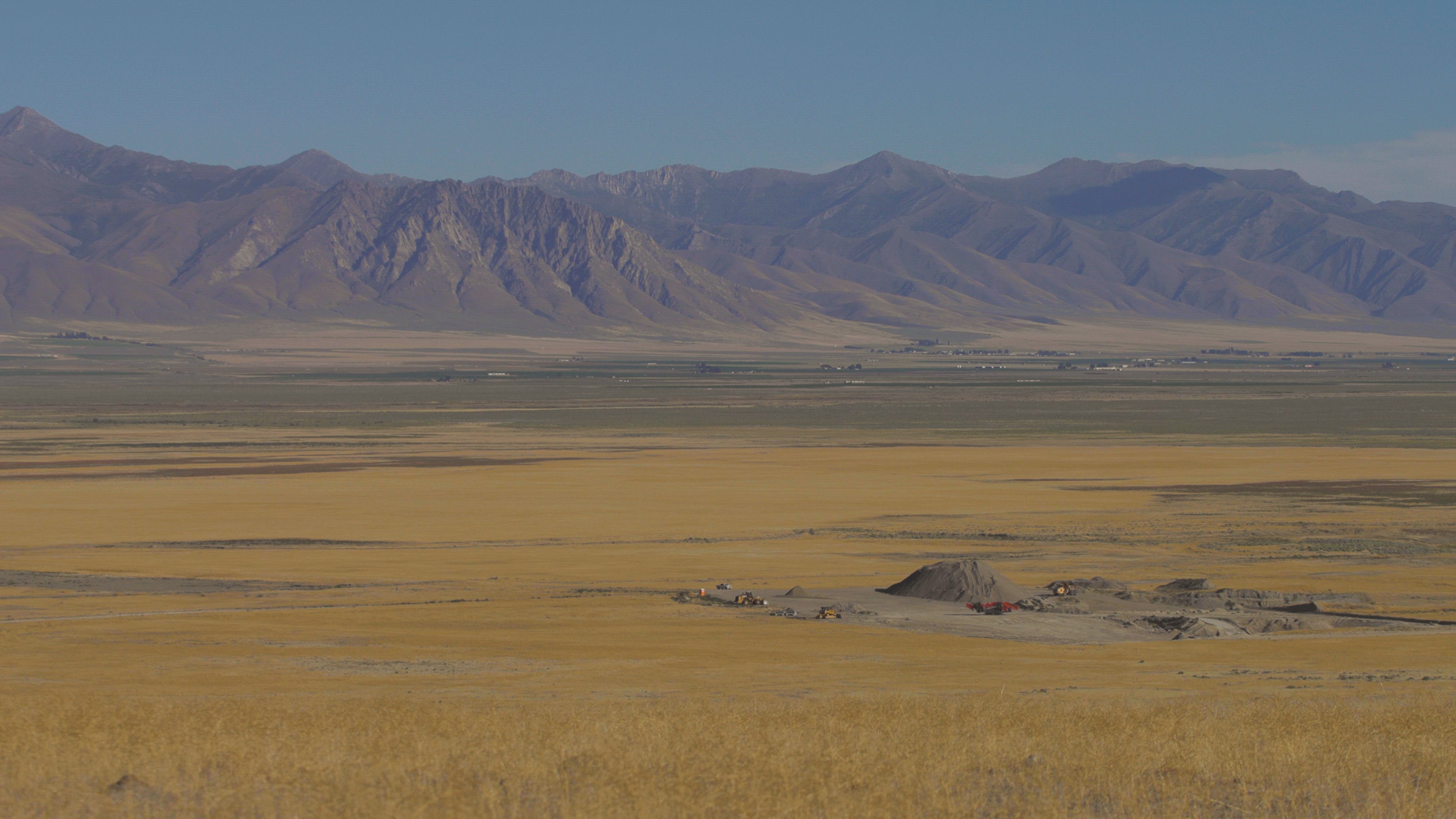
Domestic expansion of lithium mining in the United States is in its early stages, so most of the projects are also in early phases of exploration and obtaining permits. That means in many cases, there is no information available yet for how much water many proposed mines plan to consume. But we had learned that water consumption would be a significant part of our investigation. Many projects don't yet have mailing addresses on record with regulators at the locations where the projects intend to mine for lithium, adding further challenges to the task of mapping the projects. But we were in luck in some ways, because we found that the vast majority of these proposed projects were located on federal public land - which meant that there would be public records.
One of the first steps required to mine on federal land is to gain control of a mining claim. Once we found those federal mining claims, we found basic information about who holds the legal claim to underground minerals. Mining claim locations are also described by the federal government using the Public Land Survey System, or PLSS, which is maintained by the Department of the Interior's Bureau of Land Management. Typically these claims are written out and include a Township, Range, and Section along with a Prime Meridian — or in short, geographical information we could use.
Our team found mining claims attached to these projects by scouring company disclosures, local land records and documents we received after filing formal public records requests. After identifying the township, range and section of a claim where a claim was located, we built by hand — feeding the location information one by one — what we believe is the most comprehensive database about proposed lithium projects in the U.S. along with their locations. We did this as we were able to plot the information on a map using the geospatial mapping software ArcGIS, where we joined our hand-built database with a map showing all possible federally owned locations for proposed lithium mines in the United States.
The data journalism was overseen by Steve Doig, a Pulitzer-Prize winning professor of data journalism at Arizona State. We also reached out and partnered with ASU's School of Geographic Sciences & Urban Planning, to ensure our mapping was accurate and contained the best-known information. Yeuling Li, a research specialist in that school, was particularly helpful.
Some of the projects and claims we learned about did have very specific information, down to quarter sections, quarter of a quarter sections, and a half of a quarter of a quarter of a section. For context, a section is typically 1 square mile. Some of the identified projects did not have detailed location information and only had 'section' information available. For those projects, we called and emailed local regulators and the owners of the proposed projects themselves to get more detailed information. However, in some cases, we were unable to obtain it. Additionally, some projects were made up of only a handful of mining claims, while other single projects contained hundreds of claims across wider swaths of land.
We chose to plot the projects on the map by selecting a single Township, Range and Section connected to the project by a mining claim, using a tool within the ArcGIS Pro mapping software to plot a point at the center of the identified section. We chose this method because it better communicated that there are a large number of lithium mining projects in the works in a particular area. It also communicated that the physical size of a project is not necessarily an indicator of a project's impact. But this means that the points we plotted do not represent the entire area of an individual lithium project, a point simply represents a piece of a project where a mining claim relevant to this project was located.
During our research, we found examples of mining companies that changed names, purchased mining rights from each other, missed claim payments, lost funding and paused projects. Telling shareholders about a mining claim with the potential to mine lithium is very different from opening and operating a lithium mine. It is a complex and time-consuming process to open a mine. Our map is a snapshot in time, and there is no guarantee that the projects we plotted will actually become operational mines.
Different regions, different data
One of our key findings is that lithium mining is a big consumer of water. Many western states have developed some sort of system on their own for managing groundwater. We chose to focus on Nevada for a part of this analysis for several reasons, including:
- It had high-quality and robust public data.
- A majority of the proposed lithium mining projects we identified are located in Nevada.
- In Nevada, the state engineer can designate groundwater basins that require additional management because of strain on the supply.
In Nevada, basins tend to be designated as at potential risk when permitted groundwater rights approach or exceed the estimated amount of water that nature replenishes each year. We decided that this was relevant because a large proportion of the Nevada projects were located directly above these already identified basins. If even a few of them start to operate and begin pumping groundwater they need, they could affect water resources for other consumers in that basin.
This is also why we decided to highlight the mines surrounding Silver Peak, the only commercially operating lithium mine in the United States. To do this we created a circle with a 50-mile radius around the Silver Peak mine. This circle covers mines in six different basins, five of which are designated as at potential risk. We did this to provide another look at the projects in the area, to show how companies were jumping to claim land that is likely to have lithium underground, which could pose a threat to underground aquifers.
Another part of our research dealt with identifying the country that is home to lithium mining companies that claim U.S. addresses. To find these locations, we primarily looked at company and project websites for their headquarters, although one or two required additional digging using disclosures filed with the Securities and Exchange Commission. We discovered the vast majority of proposed U.S. mines are actually projects from foreign companies.
To find whether a project was located on federal land, we searched federal and state permitting documents. We also checked to see whether they had mining claims on the federal MLRS website, since it contains records for land management on federal lands.
We also sought to check how many proposed lithium projects were near tribal lands. When creating a buffer around tribal lands in ArcGIS and downloaded shape files, which are data files that show geographical boundaries that can be mapped, for tribal lands from the Census Bureau. From here, we chose to map the widest interpretation of tribal lands available in the data, which includes Tribal Statistical Areas. From there we followed the process for creating a buffer that we used earlier to create the circle around Silver Peak.
We also had to come up with a relevant way to research proposed mines that really mattered. For instance, in Nevada alone we found that tens of thousands of 'claims' exist for lithium. But we knew the majority of those were not in a serious stage of exploration because we looked for the most recent documentation from the project to determine whether it was in an exploratory phase or had completed a major benchmark in the permitting process. That could include filing a technical report, a feasibility report, a public scoping plan, an operations plan, an environmental assessment or record of decision. Projects labeled NONE means Howard Center research found no documents relevant to the mines permitting process or any detailed operational plans.
Water methodology that didn't happen
Early in the project, we spent a fair amount of time trying to incorporate groundwater data collected by USGS. We wanted to use USGS data to show that monitoring wells had noticeable changes in water levels in areas close to proposed projects. The distance of monitoring wells from our identified projects, the differences in the amount of data collected at each well, and the physical characteristics of groundwater meant that any conclusions we made could be inconclusive or, possibly, inaccurate. We ended up scrapping this idea.
Using FOIA to unearth other lithium projects
The Howard Center discovered many proposed U.S. lithium mining projects, along with learning details about their proposed environmental impact, by reviewing tens of thousands of pages of company reports, permit applications and other public records we obtained through public records requests with various states where lithium deposits are known to exist.
This process included submitting records requests to seven states to request copies of various mining-related permits. See footnote for link to various records requests.
To make these requests, we needed to understand what permits are required in each state for mining projects. This can vary significantly from state to state. Different permits and other required regulatory documents can range from mineral claims, to drilling notices, to plans for groundwater withdrawal and aquifer protection, to hazardous waste management. The permits vary depending on the type of mine and mining location. Each of the states we examined had different rules and documents.
These permits are overseen by a broad array of state and regional agencies that oversee environmental protection, natural resources, mining inspection and water quality.
Standardizing water measurements for readers
When we were deep into our reporting for this project, one company told us that lithium mines used so much water they preferred to avoid talking about the amount in “gallons,” but rather, to use a different measurement that referred to how many gallons of water would cover an entire foot of depth across an whole acre of land. The measurement is called an “acre foot” of water. To someone not familiar with the term, if they heard 20,000 acre feet of water would be used, it might not seem significant. However, translating that to gallons means that the same number represents 6.5 billion gallons of water. We thought our audience would want to understand the proposed water use from mines in terms they were familiar with and could relate to. So we decided to standardize the use of gallons instead of using the acre feet term.
To accurately convert from acre feet to gallons we needed to find an appropriate source. Google has a calculator that is easily accessible but its conversation rates differ slightly from more scientific measures. We ultimately turned to the conversion rates from the U.S. Geological Survey (USGS). The number of reported acre feet was multiplied by 325,851 to find the number of gallons. The number of reported cubic meters was multiplied by 264.2 for the number of gallons.
When available, water use estimates for each project are based on the company’s own technical reports, government filings and public announcements. These numbers represent consumptive water use. When projected water use information was not directly available, we reported (if known) how much the permits noted.
Projects in early phases of exploration, testing or permitting proved to be the most challenging for our information gathering. In instances where the Howard Center could not find documents stating either expected water use or water rights plans, the water use for those mines is written as “N/A” in our data.