
MARICOPA – Farmers for decades have used huge machines to plant, grow and harvest their crops, but more and more Arizona farmers today are using tiny, remote-controlled aircraft to boost yields and save water and money.
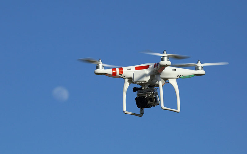
Kelly Thorp, an agricultural engineer for the Department of Agriculture’s U.S. Arid Land Agricultural Research Center in Maricopa, uses drones to monitor the center’s test fields, taking detailed images of the cotton plants to gauge the condition of the soil and how much water the crop needs.
“They’re a very powerful technology to be able to go out and regularly map fields, giving you regular information from which you can make decisions from,” Thorp said. “If we can make those decisions more accurate, then we know that we are being more efficient in our water use.”
Although irrigated agriculture has been a part of the Sonoran Desert landscape for more than 1,000 years, farming is heavily influenced by seasonal weather patterns. Arizona remains in a two-decade long drought, and climatologists predict the Southwest will continue to get warmer and drier.
The 2019 monsoon was a no-show for most of the state. Late summer storms produced some heavy rainfall, but according to the Arizona Department of Water Resources, “dry conditions in July and August continued in September, reversing the long-term drought improvements last quarter after the extremely wet winter and relatively wet spring.”
As a result, long-term drought conditions worsened, officials said, “particularly in the northern two-thirds of the state.”
That presents a constant challenge for farmers. With drones monitoring the amount of water used on their crops, farmers and agriculture engineers positively contribute to the environment and help conserve water – the most valuable resource on the planet.
“It’s an alternative to conventional farming in the sense of using information to guide decisions on input use,” said Pedro Andrade, assistant professor of agriculture at the University of Arizona. After a drone surveys the plants, the data must be analyzed and put into a machine that calculates how much water each plot needs.
Drones, either multirotor or fixed-wing, are used to assess crop conditions and fertilizer needs, predict yield potential, monitor water quality, and detect leaks and pest and disease infestations. They can be equipped with video and still-image cameras, thermal sensors to detect surface temperatures and LIDAR to create field maps in 3-D.
“So what I end up with at the end of all that,” Thorp said after a demonstration, “is essentially a map of my field that is sectioned into smaller areas that can receive different amounts of water.
“I think that drones offer a very promising future for coming up with ways to make our agricultural decision-making more resource efficient.”
Farming is a risky and expensive business, and many farmers don’t yet trust the new technology, said
Paul Brierley, executive director of the Yuma Center of Excellence for Desert Agriculture.
“They need to be convinced that by paying someone another $20 an acre to get this data from a drone,” he said, “it’s actually going to help them produce something that’s better or bigger or safer or whatever the issue is.”
Dozens of companies offer drone farming services, Brierly said, and the technology is evolving quickly.
“I think where we’re at now is they’re kind of trying to prove themselves, so different companies are coming with services, and in many cases they are having to trial it,” he said.
For the past year, Thorp and his team have been testing this technology on his cotton plants, and they’re now looking to expand their research to other crops.
Video by Dylan McKim/Cronkite News